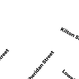
7 KILTON STREET
Owner Information
BUFORD IYANA
7 KILTON STREET
TAUNTON, MA 02780


Property Details
7 KILTON STREET is classified as a Two-Family Residential (Two family).
The primary structure on this property was built in 1890. There are 5,426ft2 of built area within this property. There is 2,796ft2 of residential/living space within this property. This property is listed as having 16 rooms.
7 KILTON STREET is valued at $298,800. The land is valued at $85,300 and the structures are valued at $213,500.
This property is in Zone 3.32. Confirm with local Zoning Board authorities to ensure there are no overlays or other easements on this property.
The most recent deed for 7 KILTON STREET is recorded at the local registrar in Book 26206, Page 261. 7 KILTON STREET was last sold on Friday, August 21, 2020 for $475,000.
Assessment data from fiscal year 2021.
Flood Data
According to the FEMA National Flood Hazard Layer, this property does not appear to be in a flood zone. It may also be in an area not yet reviewed. Nonetheless, confirm this information prior to taking any action.
To view the flood hazards around this property, create a FEMA "Firmette" Map of the area around 7 KILTON STREET.
Broadband Internet Providers
| Provider | Type | Bandwidth (mbps) | |
|---|---|---|---|
| Comcast | Cable | 1000 | 35 |
| Verizon New England Inc. | Fiber | 940 | 880 |
| Verizon New England Inc. | DSL | 10 | 1 |
| Viasat Inc | Satellite | 100 | 3 |
| VSAT Systems, LLC. | Satellite | 2 | 1 |
| HughesNet | Satellite | 25 | 3 |
| GCI Communication Corp. | Satellite | 0 | 0 |
Broadband service provider data from December 2020.
Adjacent Properties
- 14 PINE STREET
Two-Family Residential owned by COSTA ANTHONY E & RHONDA J - 5 KILTON STREET
Single Family Residential owned by TRAVERS ROBERT W JR & HIGHTOWER LINDA - 9 KILTON STREET
Three-Family Residential owned by NOGUEIRA ARTHUR - 16 PINE STREET
Two-Family Residential owned by RAPHINO LUBENS & NATASHA C - 18 PINE STREET
Two-Family Residential owned by LAU DORA & MING LUC